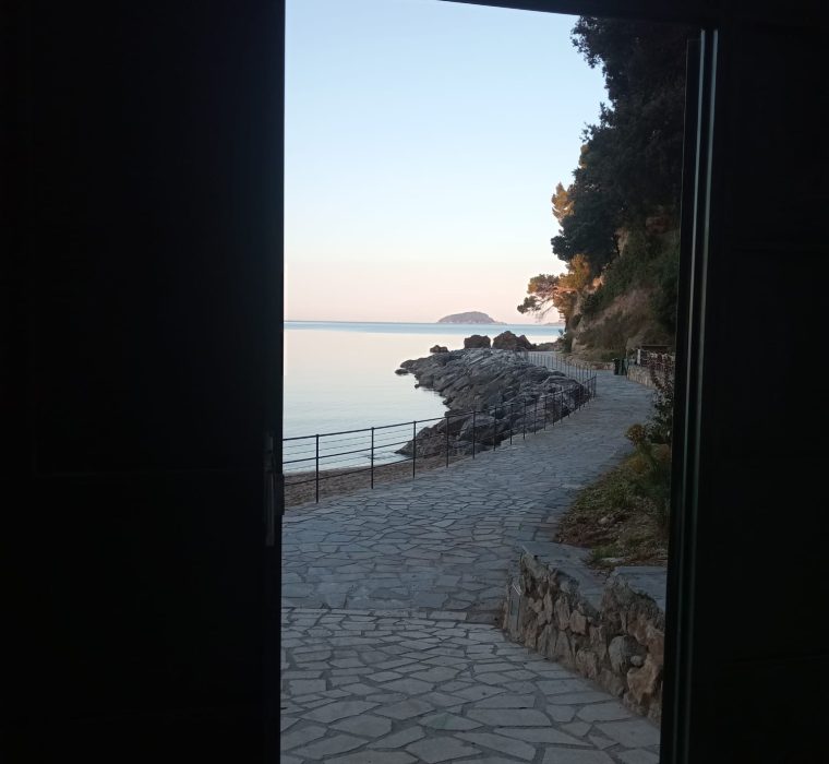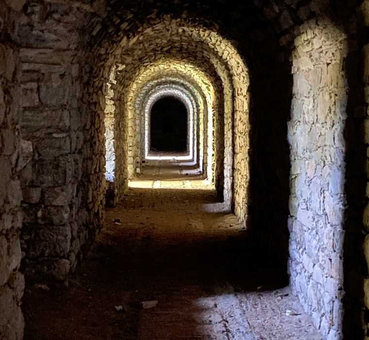

On the occasion of the redevelopment of the former air raid shelter in San Terenzo, which connects Marinella Beach with Via Garibaldi, we are offering a route through military batteries, forts, and refuges, sites of great historical and architectural value built for defensive purposes in the municipality of Lerici and surrounding areas. We are all familiar with the castles of Lerici and San Terenzo, but in this context we will accompany you to discover some more recent, though equally fascinating, military structures, among the most significant within the complex defensive system of the Gulf of La Spezia.
Rediscovering these sites together will be an opportunity to “observe” from a new point of view perhaps less famous places, silent witnesses to a daily life lived in the shadow of the great war events. It will be an evocative journey to discover the military architecture our territory, on an ideal route that combines the defensive history of the Gulf of Poets with breathtaking views.
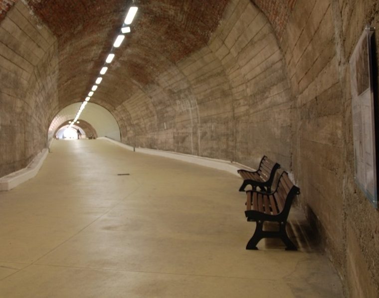
During the two World Wars, the city of La Spezia was one of the most bombed in Europe, as it was home to the first-class maritime stronghold, the Royal Navy Arsenal, and numerous military, shipbuilding, industrial, and strategic appurtenances for the war. In 1942, therefore, construction began on underground refuge tunnels intended to protect the civilian population from bombing: over 150 tunnel shelters were excavated from Portovenere to Lerici, many of which were never completed due to lack of materials and funds. On June 30, 1944, however, the tunnel “of the Marinella” in San Terenzo was completed. Approximately 110 meters long and designed to accommodate up to 1,500 people, it has recently been redeveloped and designated for pedestrian traffic. It wasn’t the only refuge in the area: the largest and most impressive, designed to accommodate up to 6,500 people – but never completed – is the one we undoubtedly travel most often today: the tunnel called “of the Scoglietti”, now used by the road connecting Muggiano and San Terenzo.
Equally well-known and very popular is the tunnel connecting Calata Mazzini to the small beaches of San Giorgio, in Lerici: here we find the elevator that leads to the foot of the castle. Intended to accommodate 2,500 people, this shelter was 75% complete: in fact, it still features sections of live rock in the final stretch
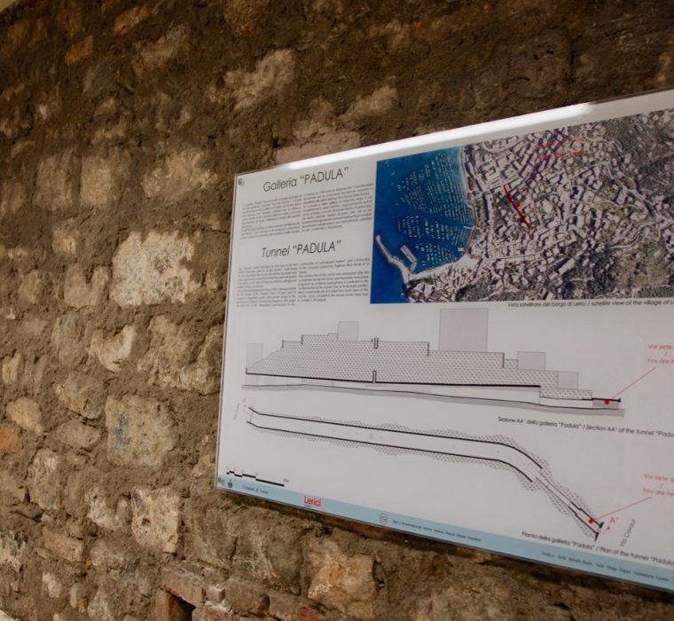
Also in Lerici, the Galleria “Padula” was supposed to hold 2,100 people and was built to a design by engineer Franco Oliva, who also designed the Palazzo Civico. Redeveloped in 2019, it connects two important arteries of the historic center, Via Gerini and Via Cavour. Although unfinished, it is the tunnel where, even today, the characteristic elements of war shelters can be best recognized, such as the central ventilation chimney and the bayonet entrance (Via Cavour side), which leads to the central chamber intended to house refugees. The Gallery “Padula” has been promoted as a historical-architectural asset and a place of collective memory, thanks to the installation of panels illustrating its history, construction techniques, and many curiosities about air raid shelters and life in the shelters so numerous in the Gulf of La Spezia
The Lerici area, always strategic for controlling the seas, as demonstrated by the two castles that guard the ends of its gulf, has undergone several interventions over the centuries to strengthen its defensive system. Significant were those carried out by the Republic of Genoa between the 16th and 17th centuries – which affected the castles of Lerici and San Terenzo – and in the ’90s of the 18th century, designed by the engineer Giacomo Brusco who also designed the Maralunga Battery in 1794. Consisting of a semi-hidden structure that was difficult to identify from the sea, it was intended to cover the part of the gulf opposite the Palmaria and the Tino islands.
It was built on the promontory of the same name where, since the 16th century, the Convent of the Augustinian Fathers and the church dedicated to the Madonna of Maralunga stood. This church housed a precious wooden icon of the Virgin, which tradition holds was miraculously resold on this cliff in 1480. The panel is still visible in the Sanctuary dedicated to it, inside the Parish Church of San Francesco, while the battery and the convent, unfortunately, gave way to a coastal battery of the Italian Navy at the end of the 19th century. The post-unification period, however, was the most prolific in terms of renewal and strengthening of the coastal defensive apparatus, intended to protect the maritime stronghold, the Arsenal of the Royal Navy and its appurtenances.
The construction of the Arsenal, inaugurated in 1869, profoundly influenced the urban transformation of the entire coastal and hilly stretch of the Gulf of La Spezia, with substantial repercussions on the landscape, demographic, social and economic context of the entire area. Lerici was not unscathed by this transformation. The same breakwater (approximately 2,300 metres long), initially built underwater in the 1870s and later raised to also act as a breakwater, was designed to narrow access to the gulf to just two openings easily covered by battery fire: the 400m wide Santa Maria dam on the Porto Venere side, and the 300m wide Santa Teresa dam on the Lerici side. In order to protect the eastern entrance to the Gulf of La Spezia, right near San Terenzo and Pozzuolo, the batteries of Falconara, Santa Teresa Alta, Santa Teresa Bassa, Punta Santa Teresa and Pianelloni were built a short distance from each other, to cross fire with artillery positioned on the opposite stretch of coast.
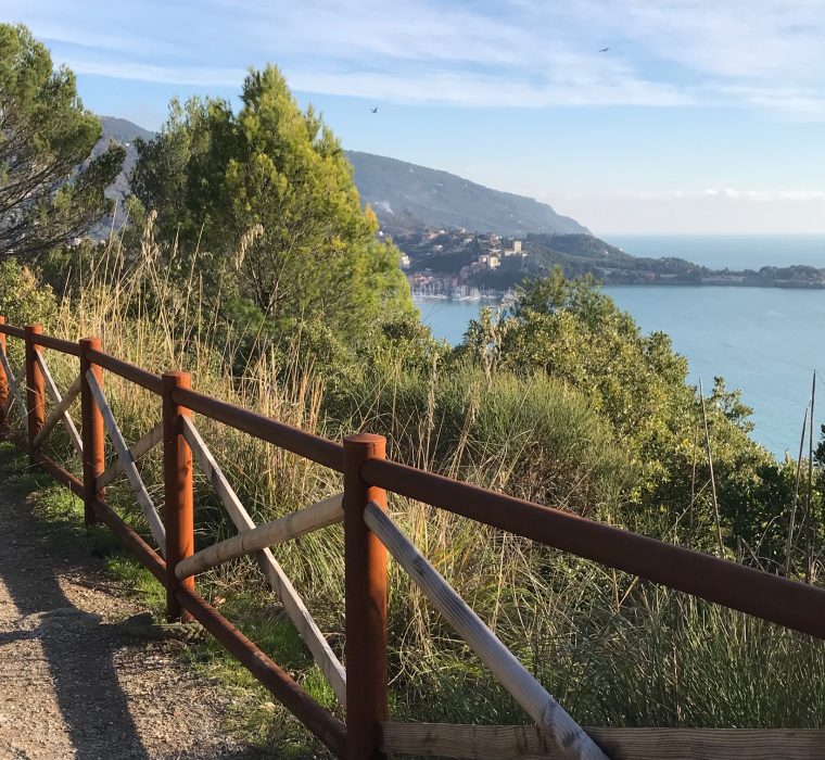
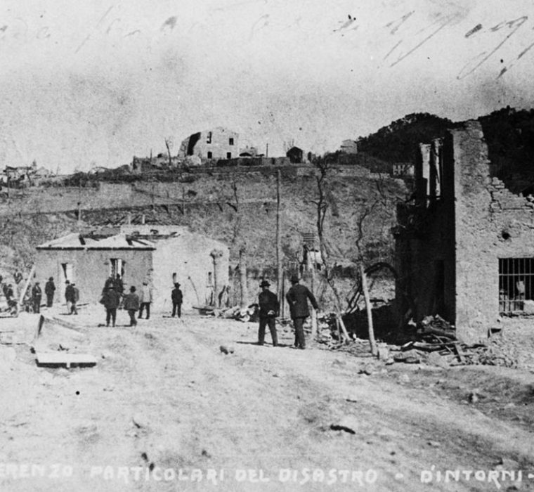
To discover the history of these 19th-century military fortifications, we propose a walking itinerary that begins right from San Terenzo. In Piazza Brusacà we find “Salita Falconara” (CAI path 413 – 600mt – approximately 20 minutes of easy ascent) which leads to the promontory of the same name where, immersed in the most typical vegetation of the Mediterranean scrub, with a view that ranges from Lerici to the islands of Tino and Palmaria, up to Porto Venere and La Spezia. A sports center and a circular route – suitable for pleasant walks (even with our four-legged friends!) – have replaced the Falconara Battery (1877 – 90 m above sea level), sadly famous for the explosion that destroyed it in September 1922, causing hundreds of victims and the destruction of homes in Pozzuolo and San Terenzo. At the end of the First World War, the military building was used as a depot for large quantities of powder and ammunition: this choice decreed its tragic end. On the occasion of the centenary, the Park was redeveloped and enhanced with a thematic-didactic path created in collaboration with the Pro Loco del Golfo APS: bilingual illustrative panels allow you to rediscover the history of the Falconara Battery and the complex 19th-century fortified system of the Gulf of La Spezia.
Our next stop is the bay of Santa Teresa, the hub of an environmental and research project called Smart Bay Santa Teresa: here we find a School of the Sea and the mussel purification center of the Cooperativa Mitilicoltori Spezzini, in which the entire cycle of purification and packaging of the typical mussels from La Spezia takes place. To get to Santa Teresa, we can simply take the road (about 1.5 km – 20 minutes on foot) or choose, alternatively, a shorter and more evocative route by taking the CAI452 path (just beyond Falconara, on the left) which descends, through terraced fields, to the Baia Blu (the Blue Bay). After walking along Baia Blu to the opposite end and passing the beach resort, we will find a narrow staircase that leads, always keeping left, to the promontory of Santa Teresa. Due to its strategic location, the small bay was home to an initial battery designed during the 17th century by the Republic of Genoa and built in the 18th century. Generally called the “Lower Battery”, it is now partially renovated and houses the Scuola di Mare, which promotes activities, both sporting and study, aimed at raising awareness of the beauty and fragility of the marine ecosystem. In the 19th century, the defensive and control functions of the Lower Battery were strengthened by the construction of the Upper Battery (1877-79, 50 metres above sea level, a structure currently used by ENEA) and the Punta Santa Teresa Battery, at the extreme tip of the spit of land that juts out towards the breakwater, the extreme control point over the eastern gap, built for the purpose of installing floating mobile obstructions. In the 1920s the site was reused for a further new installation, called Batteria Querini, with the aim of naval and air interdiction, to support the battery below.
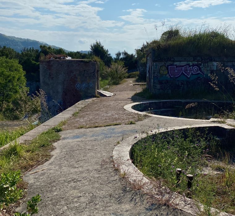
After leaving Santa Teresa, following the road, we can reach another point of notable historical and panoramic interest: the Pianelloni Battery, the strategic building of the internal defense of the Gulf of La Spezia (on foot, 1.5 km, about 20 minutes). The structure, regular and carefully finished, including aesthetically pleasing, was built around 1880. Not being usable for anti-aircraft fire, it was not targeted during the Second World War and therefore has an architectural structure still in good condition. Decommissioned after the Second World War, the entire complex is not yet accessible to the public –except on special occasions – because it awaits structural interventions for safety and enhancement.
Let’s change sides and leave the coastal batteries to reach more “hilly” stages, which will allow us to discover extraordinary new panoramas and military structures also designed for defense against attacks from the hills.
Canarbino military fort (Arcola) 1882-1887
About 280 mt above sea level
Leaving the Piannelloni we can also reach the Canarbino fort on foot, with a pleasant, non-binding route, although quite long and, at times, uphill (about 4km, 1 hour and 30 minutes). From Via Pianelloni, a staircase on the left leads near “Bar Pozzuolo”; from here, continue past the small church of San Giovanni to Tre Strade. We are still on the CAI413 path and continue following it, taking a climb on the right, up to the Pin Bon area: from here it is sufficient to follow the road, for about 3 km, up to the Canarbino Fort. This road, which coincides with a stretch of the Alta Via del Golfo (AVG), was built precisely to reach the fort: little traveled and very panoramic, it ends right near the structure, on the top of the hill. For those who prefer a car, Forte di Canarbino can be reached in about 15 minutes (just over 6 km), passing through Tre Strade, Pitelli, and Pin Bon. Protected by a ”dry” moat, it houses a dynamic sports shooting center.
Rocchetta military fort e literary park P.B. Shelley
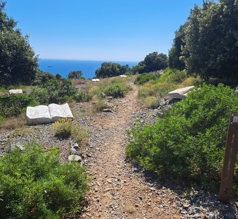
Fort Rocchetta (1880, about 400 mt above sea level)is a military structure that is still in operation, so it is not open to the public, but this excursion is truly unmissable due to the scenic and panoramic context in which the fort is located. Once you reach the Church of the Madonna della Misericordia alla Rocchetta (9 km from Pozzuolo, about 18 minutes by car –parking in front of the Church), continue along the CAI 411 path to the so-called “pietraia”, a large rocky plateau, the result of mining activities and processing waste for the construction of the adjacent fortification. Rich in fragrant Mediterranean scrub, lapped by a centuries-old holm oak forest and overlooking the deep blue sea, with views of the islands of Palmaria, Tino and Tinetto, Pietraia is today the heart of the Percy B. Shelley Literary Park. Here you can admire the artistic installations created by Marco Nereo Rotelli: marble books on which are written the verses of the famous Romantic poet who spent the last months of his life in San Terenzo, in 1822. We are at about 400 meters above sea level and the fort erected on this hill was intended to monitor not only the gulf, but also the lower valley of the Magra River: climbing along the path, in fact, we can admire the entire coast from Bocca di Magra to Versilia, framed by the splendid profile of the Apuan Alps. The trails you can take on Mount Rocchetta are numerous and all extraordinarily panoramic, but to complete our concise itinerary between the sites of war and military memory, we suggest reaching one of the most significant and iconic places in Lerici’s most recent history: Villa Volpara, known as “il Fodo”. Of seventeenth-century origin, the Villa played a fundamental role during the Second World War, becoming home to a clandestine printing house that worked continuously for over nine months, from November ‘43 until September ‘44. The printing house was placed inside an underground cistern in the villa’s farmyard, so that no noise could be heard during operation. Here the Partisans clandestinely printed thousands of anti-fascist leaflets and newspapers that were then distributed throughout the province. (CAI 411-426 – stage of the Literary Park circuit).
Valdilocchi battery (La Spezia)
Valdilocchi battery (Comune della Spezia)
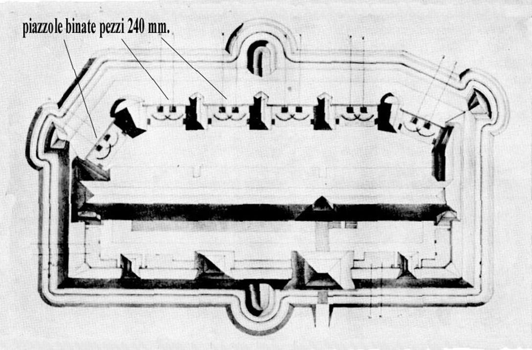
Moving to the Municipality of La Spezia, we can discover numerous other sites of great interest, from the panoramic Parco delle Mura to the Quintino Sella Gallery, another example of a redeveloped air raid shelter, located in the heart of the city (Via del Prione). Here, however, we limit ourselves to suggesting a site very close to Lerici, which will allow us to complete our itinerary to discover the nineteenth-century defensive belt protecting the eastern side of the Gulf of La Spezia: Valdilocchi battery, near Pagliari, is less than 8km from San Terenzo. The dominant position allowed the eastern approaches of the Migliarina plain, Val di Magra and Val di Vara to be controlled by crossing fire with other nearby batteries. Leaving your car in a public parking lot near the Cimma sports field (Gandolfo sports center), a short walk on the white road (about 800 meters) will take you to the battery, from which you can enjoy a splendid view of the gulf. To visit the battery, you can follow the Fb profile of the Pro Loco del Golfo APS, which organizes guided tours inside.